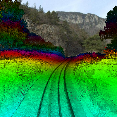
Cartographie 3D du réseau ferroviaire MGB/GGB 3D-Mapping Zugstreckennetz MGB/GGB 3D Mapping of MGB/GGB railway network
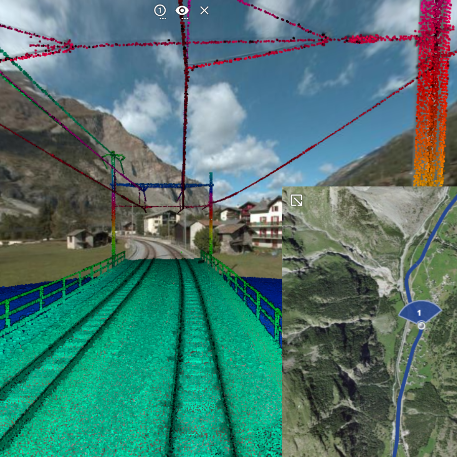
Client: Matterhorn-Gotthard Bahn (MGB),Gornergrat-Bahn (GGB)
Durée: depuis 2021 avec actualisations régulières
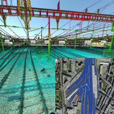
Etendue: Réseau ferroviaire complet (200km)
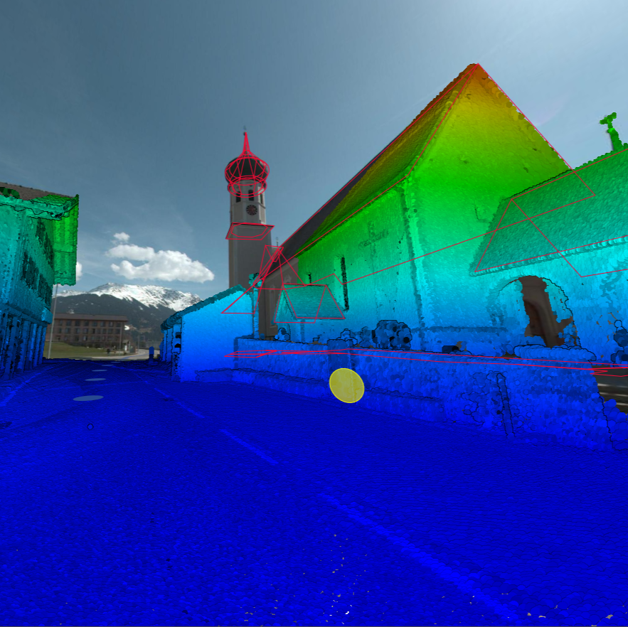
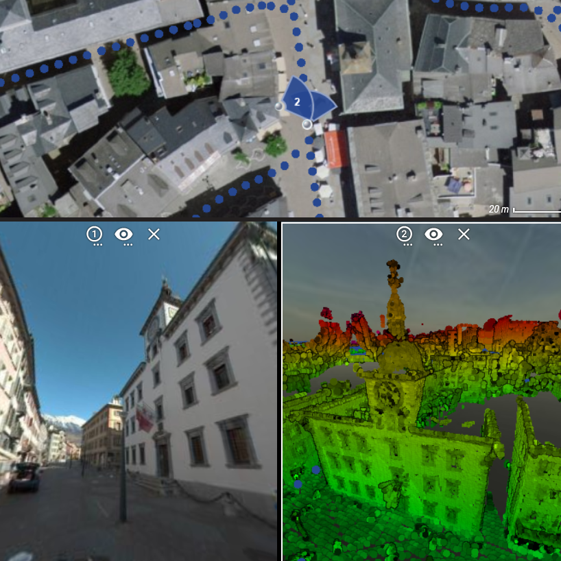
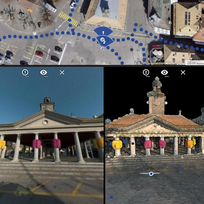
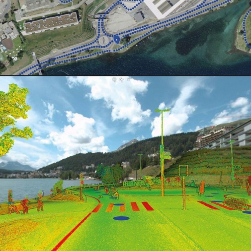
Description: Acquisition d'images 360° et données laser haute densité sur rail, analyse gabarits d'espace libre et mise à disposition d'une plateforme web 3D
Kunde: Matterhorn-Gotthard Bahn (MGB),Gornergrat-Bahn (GGB)
Dauer: Seit 2021 mit regelmässigen Aktualisierungen
Umfang: Gesamtes Schienennetz (200km)
Beschreibung: Erfassung von 360°-Bildern und Laserdaten mit Mobile Mapping auf der Schiene, Freilichtraum-Analyse, Einbindung in ein 3D-Webportal
Client: Matterhorn-Gotthard Bahn (MGB),Gornergrat-Bahn (GGB)
Duration: Since 2021 with regular updates
Extend: Complete rail network (150km)
Description: Capture with Mobile Mapping on rail of 360°-images and high-density laser data on rail, analysis of free space templates and provision of a 3D web platform